Drone Real Estate Photography in the DC Metro Area: Where You Can Fly and Where You Can’t
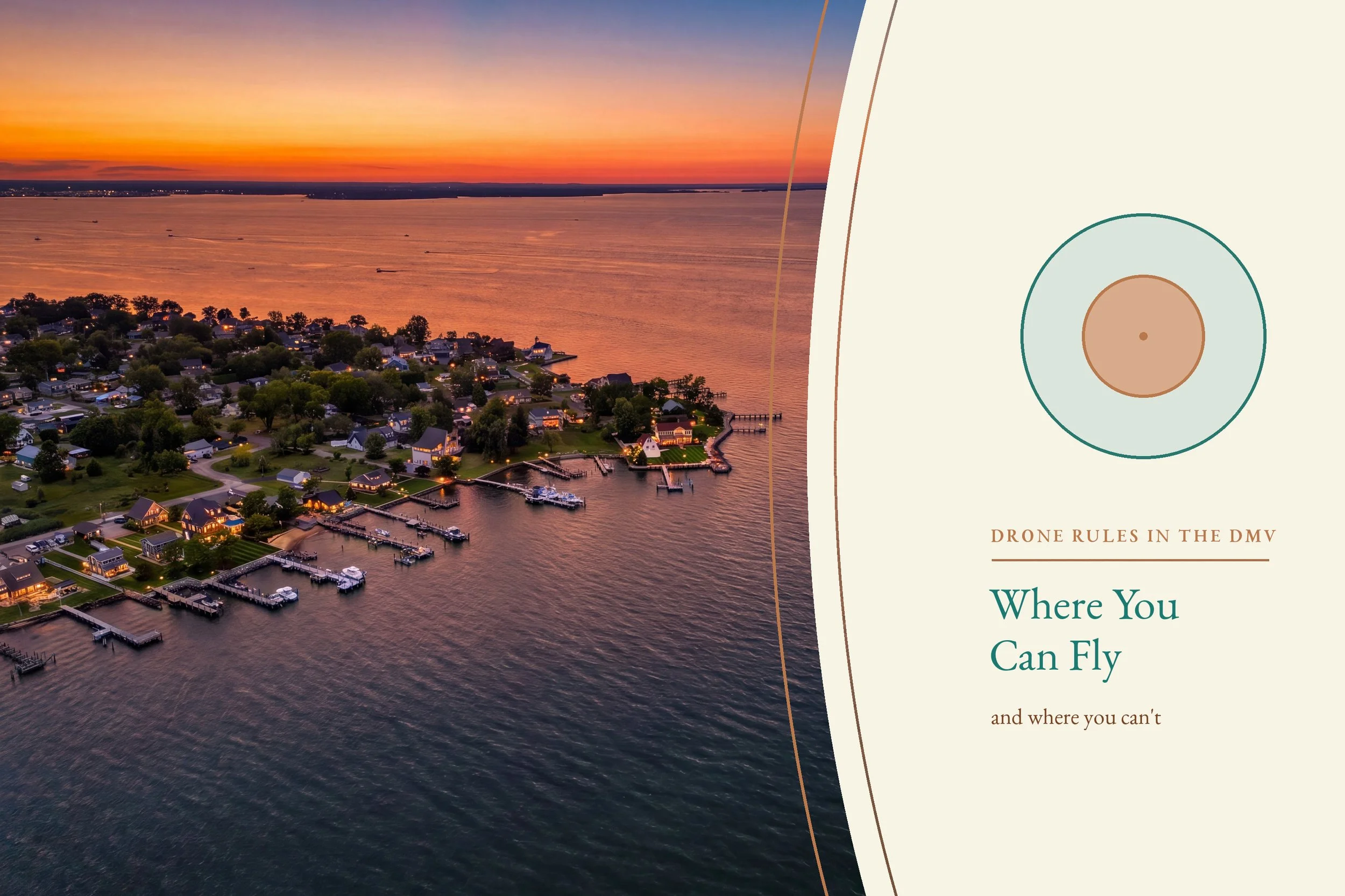
Every few weeks an agent sends us a listing address in Arlington with a note that says something like "let's get some drone shots of the lot." It's a completely reasonable request in almost any other market in the country. Here, it's a request to break federal law.
That's not an exaggeration and it's not a scheduling problem we can work around. The Washington area has the most restricted airspace in the United States, and a large share of the DMV's most expensive listings sit inside a zone where flying an unmanned aircraft is flatly prohibited. If you're marketing homes in this region, knowing exactly where that line falls is worth more than any lens we own.
Here's how the airspace actually works, which of your listings can have aerial photography, and what we shoot instead when they can't.
1. Why This Matters More Here Than Anywhere Else
Drone photography has quickly become an industry standard. NAR's 2025 REALTORS® Technology Survey found that 52% of members use drone photography or video — a distant third behind eSignature at 79% and social media at 75%, but ahead of every other tool agents reported using. It isn't a premium add-on you talk a seller into anymore. It's what the listing down the street already has.
The timing matters too. Bright MLS's July 2026 report counted 11,431 active listings across the DC area — 11.2% more than a year earlier, and the highest inventory level since 2019. Buyer activity cooled at the same time: showing appointments ran 4.7% below last year, and the median price edged up just 1.6%, to $650,000. More homes competing for fewer eyes is exactly the market where an aerial establishing shot earns its keep.
Which is a problem, because in Arlington, Bethesda, Alexandria, and most of the close-in DMV, you can't even put a drone in the air.
2. The Two Rings: How Washington's Airspace Is Drawn
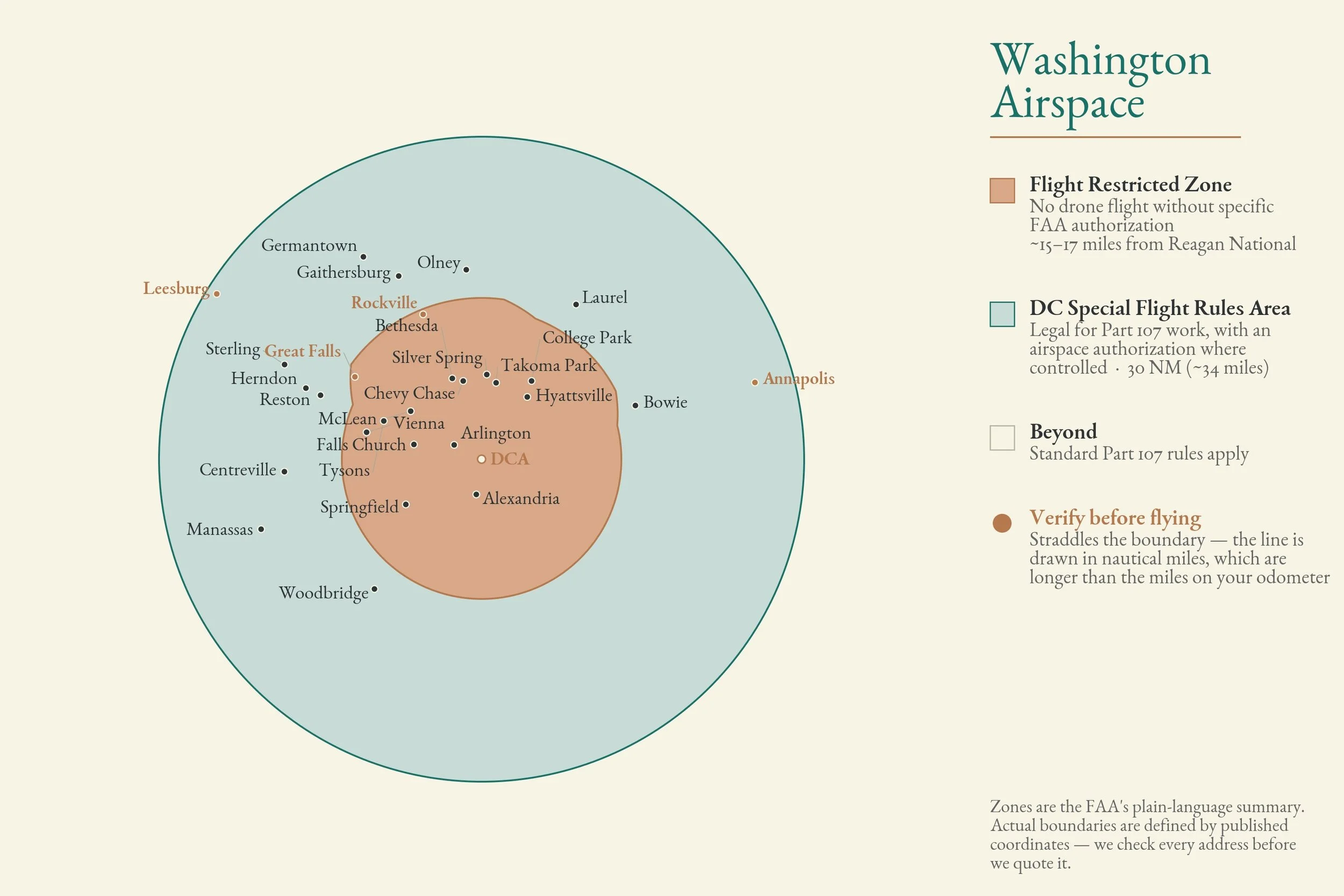
After 9/11, the FAA built a permanent set of flight restrictions around the capital. For drone purposes it comes down to two zones, both measured from Reagan National Airport.
The inner zone is the Flight Restricted Zone, or FRZ. The FAA's guidance is unambiguous: flying an unmanned aircraft here is prohibited without specific FAA authorization. This is the area the FAA labels a "No Drone Zone." It isn't a neat circle — the boundary runs about 17 miles out to the north and northwest and about 15 miles in most other directions.
The outer ring extends 30 nautical miles — roughly 34 miles — from Reagan National, forming the boundary of the DC Special Flight Rules Area, or SFRA. Drone flight is permitted between the FRZ edge and the SFRA edge, but commercial work has to comply with Part 107 — and a listing shoot is commercial work, every time, without exception.
Violations inside these zones aren't handled like a parking ticket. The FAA's language is that violators face stiff fines and criminal penalties, because the restrictions are national defense airspace.
3. Inside the Inner Ring: Where the Drone Stays in the Case
If your listing is in Arlington, Alexandria, Falls Church, McLean, Tysons, Bethesda, Chevy Chase, Silver Spring, Takoma Park, College Park, Hyattsville, Springfield, Vienna, or most of inner Fairfax, you are inside the FRZ. No aerial photography. Not at 50 feet, not "just a quick one over the backyard," not with a small drone.
This catches people off guard because these are not remote federal installations — they're ordinary residential neighborhoods full of $900,000 colonials. A house on a quiet street in Bethesda is subject to the same prohibition as one across from the Pentagon.
The practical rule for agents: if your listing is inside the Beltway or anywhere close to it, assume no drone until proven otherwise.
4. The Outer Ring: Legal, With the Right Paperwork
Once you're outside the FRZ, aerial photography is on the table. Reston, Herndon, Sterling, Gaithersburg, Germantown, Manassas, Centreville, Woodbridge, Bowie, Laurel, and Olney generally fall in this band.
Two towns need an asterisk. Rockville and Great Falls straddle the FRZ boundary — most of Rockville south of King Farm and most of Great Falls southeast of Riverbend are inside the restricted zone, not outside it. They look clear on a map because the FAA measures in nautical miles, which are longer than the miles on your odometer. Treat both as no-fly until the specific address has been checked.
"On the table" is not the same as "just launch." Commercial drone work in this ring requires a Part 107 remote pilot, and much of the outer ring also sits inside controlled airspace belonging to Dulles, BWI, Manassas Regional, Leesburg Executive, Montgomery County Airpark, or College Park. Controlled airspace means an FAA airspace authorization on top of everything else.
The good news is that this part is fast. LAANC — the FAA's Low Altitude Authorization and Notification Capability — automates those requests against published airspace data and returns approvals in near-real time at more than 500 participating facilities covering over a thousand airports. A properly credentialed operator can clear a Reston listing in minutes, not weeks. What LAANC will never do is get you into the FRZ; there is no instant authorization for the inner zone.
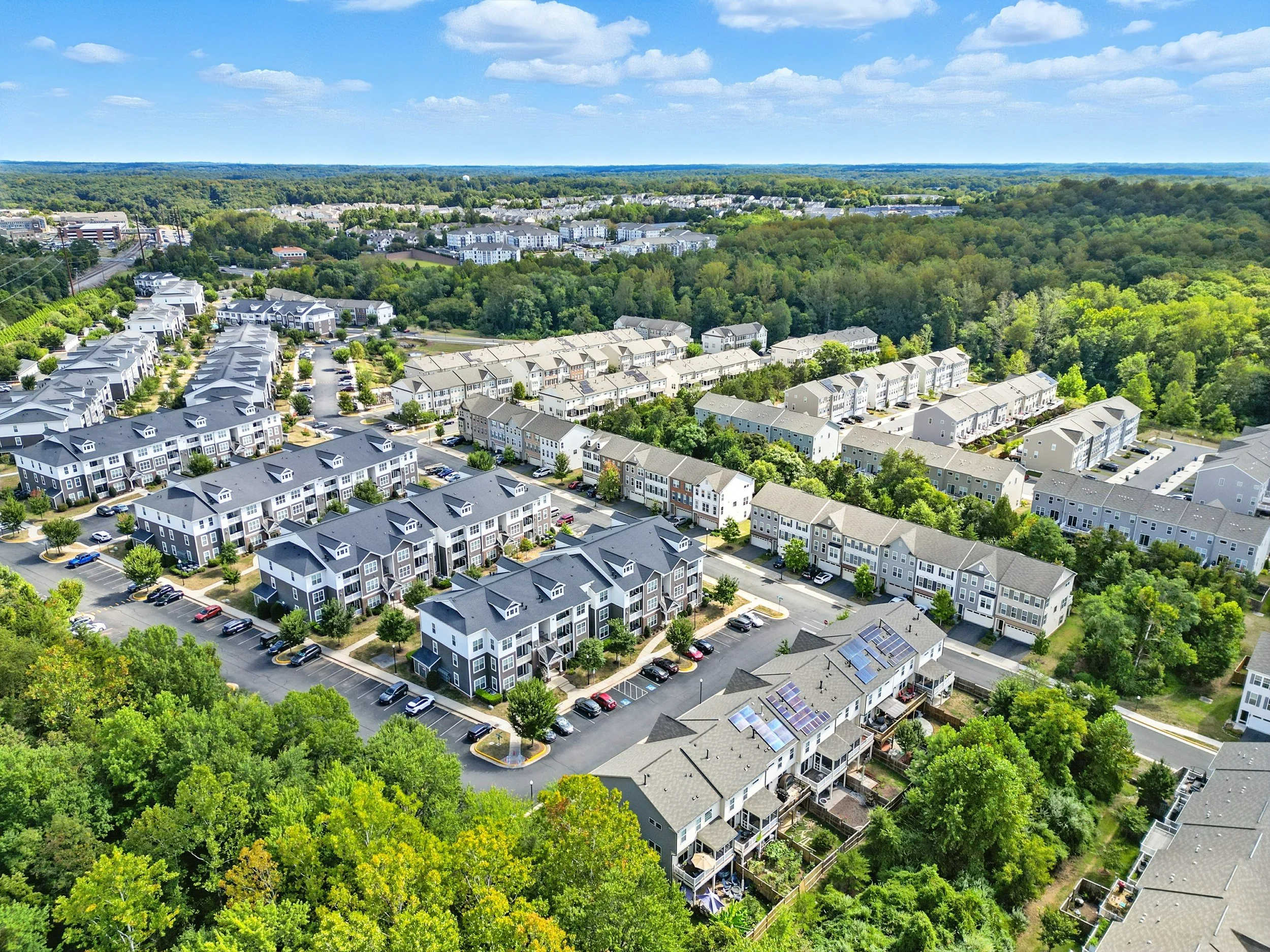
A suburban community photographed from the outer ring, where aerial work is legal with a Part 107 pilot and a LAANC authorization filed before takeoff.
5. The Waiver Myth
The single most common follow-up question we get: "Can't you just get a waiver?"
Technically, the FRZ isn't absolutely sealed. Experienced Part 107 and public aircraft operators can apply through the FAA's Airspace Access Program, which runs through TSA vetting, requires special governmental interest or certificate-of-authorization approval, and has to be filed at least 15 business days ahead. In practice, that pathway exists for public safety, infrastructure inspection, and government operations. It is not a mechanism for photographing a listing, and no legitimate operator is going to get one for a Tuesday morning shoot in Arlington.
If a photographer tells you they can fly your FRZ listing, they are either misunderstanding the rules or planning to break them. Neither is a risk worth attaching to your brokerage's name.
While we're here — NAR's own guidance on hiring aerial operators is worth following anywhere in the country: verify the Remote Pilot Certificate, confirm liability insurance, and make sure your contract addresses image copyright and indemnification. Part 107 also carries operating limits that apply everywhere in the outer ring: 400 feet above ground level, 100 mph, visual line of sight, and Remote ID compliance.
6. What We Shoot Instead
An FRZ listing still needs an establishing shot. It just needs a different tool to get one.
Elevated ground photography. A mast or pole rig puts the camera 20 to 30 feet up. That's not a bird's-eye view, but it's well above the parked cars, the neighbor's fence, and the shrub line — which is what was actually ruining the front exterior. For a townhome in Del Ray or a corner lot in Arlington, elevated is frequently the shot people thought they wanted from a drone.
Deliberate ground-level composition. Wide exteriors shot from the opposite sidewalk, angled to show depth of lot and the relationship between house, driveway, and yard. Most of what an aerial communicates about a suburban property — how the lot sits, how much of it there is — can be composed from the ground by someone paying attention.
Twilight exteriors. A dusk shot of a lit house does more for a click-through rate than a mediocre overhead ever did, and it's legal on every street in the DMV.
Neighborhood and amenity context. Metro proximity, the park at the end of the block, the school two streets over. Buyers usually want aerials for orientation, and you can give them that without leaving the ground.
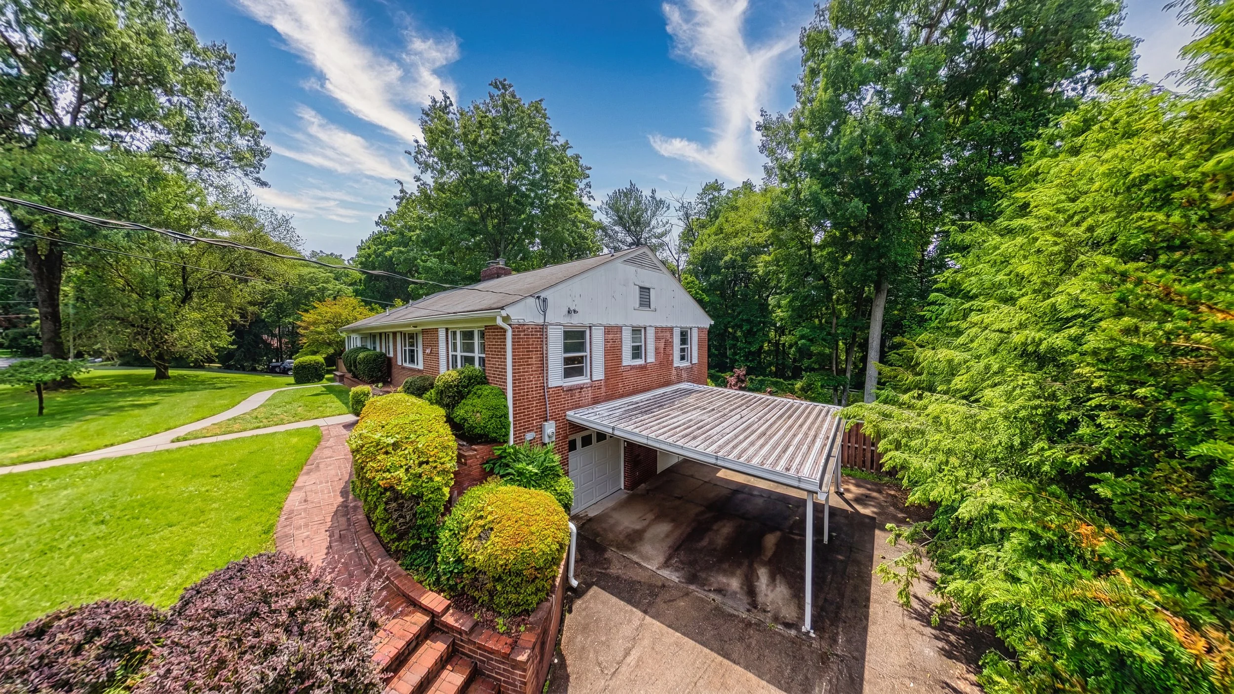
Shot from a mast at roughly two stories — no aircraft, no authorization, and the lot still reads the way an aerial would have shown it.
7. Which Listings Actually Earn Their Aerial Budget
Even where flying is legal, aerial isn't automatic. It earns its place when the property's value is partly in the land or the setting: acreage in Loudoun or western Montgomery County, waterfront and water-adjacent homes, farms and equestrian properties, homes backing to parkland, and anything where the parcel is the story. Our waterfront listings work leans on aerial for exactly this reason.
It earns much less on a townhouse in a dense subdivision, where an overhead frame mostly shows roofs and your neighbor's above-ground pool. If the aerial doesn't tell a buyer something the ground shots can't, it's a line item, not an asset.
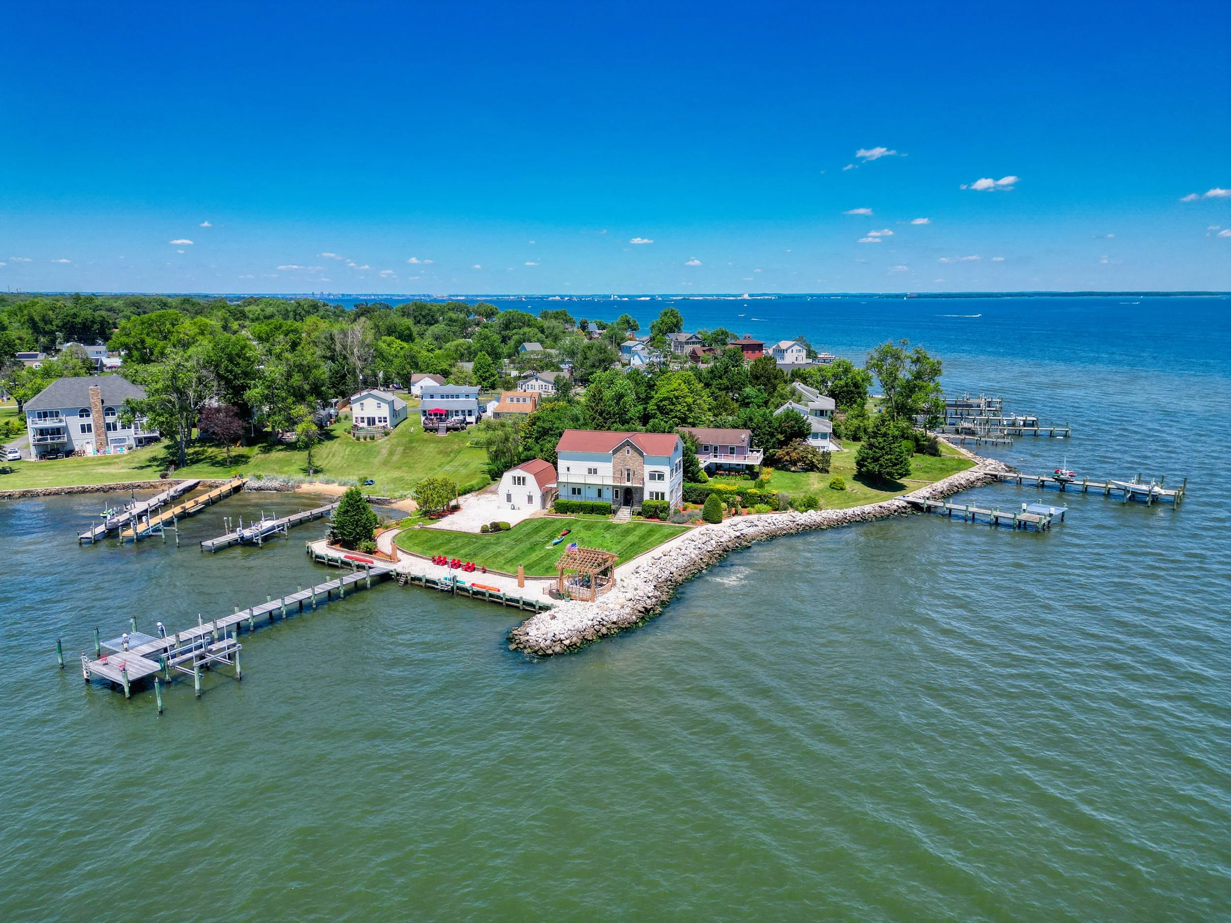
When the parcel is the story — a waterfront point lot where the aerial shows a buyer something no ground-level frame can.
8. What to Ask Before You Book
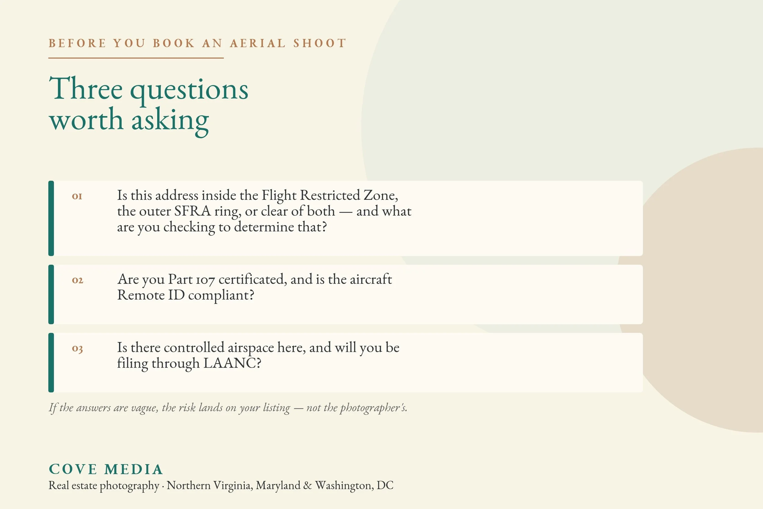
Three questions, and any competent operator answers all of them without hesitating:
Is this address inside the FRZ, the outer SFRA ring, or clear of both — and what are you checking to determine that? Are you Part 107 certificated, and is the aircraft Remote ID compliant? Is there controlled airspace here, and will you be filing through LAANC?
If the answers are vague, the risk lands on your listing and your license, not the photographer's.
We shoot across the entire DMV and we check the airspace on every address before we quote it — so you'll know whether aerial is available for your listing before it becomes a scheduling problem. If it isn't, we'll tell you what we'd shoot instead and why it works. Aerial pricing and what's included in each package is on our pricing page, and if you want a straight answer about a specific address, send it over and we'll check it for you before you book.
For a broader look at what aerial and other add-ons run in this market, see our 2026 pricing guide.